


KIPDA Area Development District (Southeast) PUMA, Kentucky
About
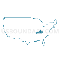
Outline
+PUMA%2c+Kentucky_A280.png)
Summary
| Unique Area Identifier | 192967 |
| Name | KIPDA Area Development District (Southeast) PUMA |
| State | Kentucky |
| Area (square miles) | 689.50 |
| Land Area (square miles) | 678.20 |
| Water Area (square miles) | 11.30 |
| % of Land Area | 98.36 |
| % of Water Area | 1.64 |
| Latitude of the Internal Point | 38.04477960 |
| Longtitude of the Internal Point | -85.46395740 |
Maps
+PUMA in Kentucky.png)
Graphs
Select a template below for downloading or customizing gragh for KIPDA Area Development District (Southeast) PUMA, Kentucky
+PUMA%2c+Kentucky_T0.png)
+PUMA%2c+Kentucky_T1.png)
+PUMA%2c+Kentucky_T2.png)
+PUMA%2c+Kentucky_T3.png)
+PUMA%2c+Kentucky_T4.png)
+PUMA%2c+Kentucky_T5.png)
+PUMA%2c+Kentucky_T6.png)
+PUMA%2c+Kentucky_T7.png)
+PUMA%2c+Kentucky.png)
Neighbors
Neighoring Public Use Microdata Area (by Name) Neighboring Public Use Microdata Area on the Map
- Bluegrass Area Development District (West) PUMA, KY
- KIPDA Area Development District (Northeast) PUMA, KY
- KIPDA Area Development District (West)--Louisville/Jefferson County (Northeast) PUMA, KY
- KIPDA Area Development District (West)--Louisville/Jefferson County (South Central) PUMA, KY
- KIPDA Area Development District (West)--Louisville/Jefferson County (Southeast) PUMA, KY
- KIPDA Area Development District (West)--Louisville/Jefferson County (Southwest) PUMA, KY
- Lincoln Trail Area Development District (East) PUMA, KY
- Lincoln Trail Area Development District (West) PUMA, KY
Top 10 Neighboring County (by Population) Neighboring County on the Map
- Jefferson County, KY (741,096)
- Hardin County, KY (105,543)
- Bullitt County, KY (74,319)
- Oldham County, KY (60,316)
- Franklin County, KY (49,285)
- Nelson County, KY (43,437)
- Shelby County, KY (42,074)
- Anderson County, KY (21,421)
- Spencer County, KY (17,061)
Top 10 Neighboring County Subdivision (by Population) Neighboring County Subdivision on the Map
- Elizabethtown CCD, Hardin County, KY (49,288)
- Frankfort CCD, Franklin County, KY (46,507)
- Pond Creek CCD, Jefferson County, KY (44,850)
- Northeast Jefferson CCD, Jefferson County, KY (40,424)
- Pewee Valley CCD, Oldham County, KY (36,147)
- Shepherdsville Northwest CCD, Bullitt County, KY (34,819)
- South Jefferson CCD, Jefferson County, KY (30,057)
- Shelbyville CCD, Shelby County, KY (25,558)
- South Dixie CCD, Jefferson County, KY (24,955)
- Mount Washington CCD, Bullitt County, KY (24,503)
Top 10 Neighboring Place (by Population) Neighboring Place on the Map
- Louisville/Jefferson County metro government (balance), KY (597,337)
- Shelbyville city, KY (14,045)
- Shepherdsville city, KY (11,222)
- Mount Washington city, KY (9,117)
- Hillview city, KY (8,172)
- Simpsonville city, KY (2,484)
- Brooks CDP, KY (2,401)
- Pioneer Village city, KY (2,030)
- Lebanon Junction city, KY (1,813)
- Elk Creek CDP, KY (1,539)
Top 10 Neighboring Elementary School District (by Population) Neighboring Elementary School District on the Map
Top 10 Neighboring Secondary School District (by Population) Neighboring Secondary School District on the Map
Top 10 Neighboring Unified School District (by Population) Neighboring Unified School District on the Map
- Jefferson County School District, KY (738,704)
- Hardin County School District, KY (85,779)
- Bullitt County School District, KY (74,319)
- Oldham County School District, KY (60,316)
- Franklin County School District, KY (44,856)
- Shelby County School District, KY (42,074)
- Nelson County School District, KY (30,498)
- Anderson County School District, KY (21,421)
- Spencer County School District, KY (17,061)
- Fort Knox Dependent Schools, KY (11,074)
Top 10 Neighboring State Legislative District Lower Chamber (by Population) Neighboring State Legislative District Lower Chamber on the Map
- State House District 29, KY (58,348)
- State House District 48, KY (57,316)
- State House District 58, KY (55,670)
- State House District 59, KY (55,004)
- State House District 49, KY (50,626)
- State House District 50, KY (49,478)
- State House District 55, KY (45,145)
- State House District 27, KY (44,833)
- State House District 18, KY (43,650)
- State House District 28, KY (41,513)
Top 10 Neighboring State Legislative District Upper Chamber (by Population) Neighboring State Legislative District Upper Chamber on the Map
- State Senate District 26, KY (134,003)
- State Senate District 20, KY (133,454)
- State Senate District 38, KY (131,921)
- State Senate District 7, KY (128,013)
- State Senate District 36, KY (125,909)
- State Senate District 14, KY (120,817)
- State Senate District 10, KY (120,533)
Top 10 Neighboring 111th Congressional District (by Population) Neighboring 111th Congressional District on the Map
- Congressional District 2, KY (760,032)
- Congressional District 6, KY (759,205)
- Congressional District 4, KY (741,464)
- Congressional District 3, KY (721,626)
Top 10 Neighboring Census Tract (by Population) Neighboring Census Tract on the Map
- Census Tract 10.02, Hardin County, KY (8,344)
- Census Tract 9302, Nelson County, KY (7,378)
- Census Tract 402, Shelby County, KY (7,112)
- Census Tract 10.01, Hardin County, KY (6,762)
- Census Tract 405.02, Shelby County, KY (6,424)
- Census Tract 304.01, Oldham County, KY (6,416)
- Census Tract 211.01, Bullitt County, KY (6,204)
- Census Tract 207.01, Bullitt County, KY (6,134)
- Census Tract 204, Bullitt County, KY (6,065)
- Census Tract 711, Franklin County, KY (6,056)
Top 10 Neighboring 5-Digit ZIP Code Tabulation Area (by Population) Neighboring 5-Digit ZIP Code Tabulation Area on the Map
- 40601, KY (49,566)
- 42701, KY (48,194)
- 40299, KY (38,371)
- 40272, KY (37,394)
- 40229, KY (36,852)
- 40291, KY (35,427)
- 40165, KY (32,726)
- 40245, KY (30,109)
- 40065, KY (28,025)
- 40342, KY (21,125)